This is "Onbekommerd"!

Monday, July 31, 2017

Life on Spiekeroog (and why we are here)

One of our blog followers asked us why we went to Spiekeroog and it is probably worthwhile to explain a bit.
We want to be in Amsterdam by the 24th of August. Now when you are far away, as in Mariehamn or Stockholm, getting back can seem quite daunting as there are so many variables: big crossings, weather, tide (once out of the Baltic) are the main ones. So we are conservative and use good conditions to move ahead. Now that we are relatively close (5 motoring stretches away from Delfzijl, where we plan to enter the Netherlands), we have changed our strategy a bit. We could, after Bremerhaven, have taken the inside route via the Küstenkanal or even after Fedderwardersiel the northern inside route via the Ems - Jade kanal, but then we would have been in the Netherlands already with 4 weeks to 'wait'. As we like the 'Wadden' islands, the string of islands to the north of the Netherlands and Germany, we have opted for this route. The weather is pretty unstable so the timing is not entirely our own, but we have plenty of leeway and are happy to choose the nicest islands for prolonged weather stops.
And Spiekeroog is our favourite. We walk through the dunes, over the dike and to the really pretty small village which has sort of a 'Hansel and Gretel' atmosphere. There is a really nice ice cream shop too.....

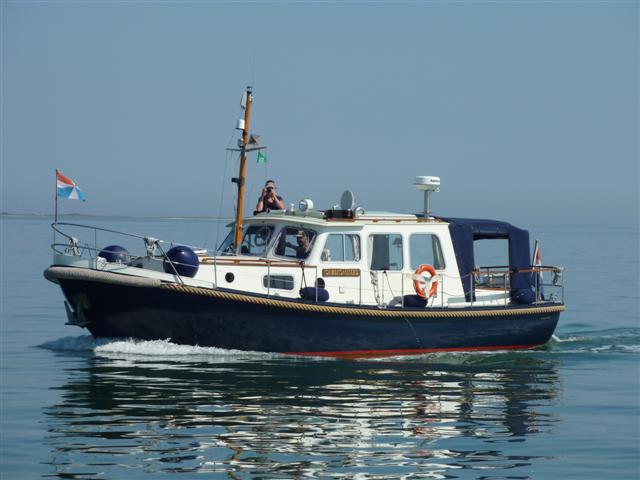
Here are a few impressions:


Location:Am Leuchtturm,,Germany

Friday, July 28, 2017

Moin moin

The title of the post is the greeting you get all day from everyone here in the North Western part of Germany. 'Hello' is probably the best translation. People are very friendly and helpful. And talking with the locals has great benefits! Whilst still in Fedderwardersiel, we asked a local skipper if and how it was possible to get to the island of Wangerooge in one tide. He showed a rather adventurous route, outside all marked fairways over the shallow grounds (which we would only do when following a local like himself). And then he mentioned that the best way to do it in two sections was to stop in Hormersiel. Now that's a little harbour on the Weser that we would otherwise not have chosen. But we took his advice and it was a delightful stopover.


There too we talked to someone about getting to Spiekeroog instead of Wangerooge, Spiekeroog being the second of the North Friesian German islands (counting from the East). He confirmed our calculations that it was possible and we set off with the extra leg past Wangerooge to Spiekeroog in the plotter and in our mind. At the entrance to Wangerooge we decided that all was going to plan and continued.

On the way we saw plenty of seals and some small dolphins.


We are now on Spiekeroog, where we will stay for three or four days. The weather is not good, with strong winds and this is a very nice island to be weather bound! More details in a later post!

Location:Am Leuchtturm,Spiekeroog,Germany

Tuesday, July 25, 2017

Boats need water (2)

Due to strong winds and rain we are still in Fedderwardersiel.

Last night's sunset was pretty impressive (yes, the sun sort of showed for an instance).


Today I had an opportunity to take a few pictures of the harbour at high tide. Compare these to yesterday's post.


If all (meaning the weather) goes to plan, we will leave tomorrow around 2 hours before high tide. Hold thumbs!

Location:Am Leuchtturm,Butjadingen,Germany

Monday, July 24, 2017

Boats need water

Boats need water. But at the moment we don't have any! Fortunately this is all planned. We are in Fedderwardersiel, a small harbour which falls dry at low tide.
This is the current view from the boat:


And this is the view of the boat:


As you can see we are in the mud, tilting forward a bit.

The harbour entrance looks like this at the moment:


When we arrived, there was 200cm water in the entrance, the red '200' line was just visible.

This yacht is (probably on purpose) very high and dry.


He'll need almost full high tide to get off again (he was very much aground already when we arrived less than 2 hours after high tide).

This is very different from the 'avoiding the rocks' scenario we had in Sweden for the last 15 months. But it's also fun!

Location:Am Leuchtturm,Butjadingen,Germany

Sunday, July 23, 2017

A different lock

As mentioned in the previous blog post, we went through a very different lock (and a very different canal). This is the Otterndorf lock and the connection between Elbe and Weser, made up of two canal stretches and a small river, the Geeste.

To start with, you enter the lock through a tunnel under a dyke. You have to wait for the tide to have dropped enough to get through the tunnel.


Once the water is low enough, the lock keeper opens the gate and directs the boats to their places. He is very particular about this, you choose your own spot at your peril.


When everyone (just 5 of us) is in position, you get 'invited' to come to his office to pay the locking fee and the canal charges, all of €8 in total!
During this time, the gate is still open for any latecomers.


Finally, the gate closes, the water drops and he directs each boat, one by one, out of the lock and into the canal.

Unfortunately we did not take any pictures of the canal. It is narrow, shallow and has a headroom restriction of 2.7m, so few boats can take this safe route between the Elbe and Weser rivers.

It's a total of 60 Km, but at a maximum speed of 8km/hr, it takes some time to negotiate. As we only got out of the lock by 15:50, we stopped halfway in Berdekesa. After that there is a self service lock at Lintig (you just push some buttons) and a final lock at Bremerhaven.

We gave ourselves a rest day at Bremerhaven and plan to go on to the tidal harbour at Fedderwardersiel tomorrow.

Sadly, the Otterndorf lock will be renovated over the next three years. It will be closed and surely when it reopens a bit of nostalgia will have disappeared.

Location:Barkhausenstraße,Bremerhaven,Germany

Thursday, July 20, 2017

Canal

We had an uneventful trip from Denmark to Germany. In Laboe we put our forth and last courtesy flag in the starboard rigging:


The last two days, we have traversed the Kiel canal, which connects the Baltic at Kiel to the North Sea, actually the river Elbe at Brunsbüttel.
This canal is used by fairly large ships and in Kiel you go through the locks with them, which is interesting.


One third of the way is the town of Rendsburg, a popular stop with a good marina. We quenched Onbekommerd 's thirst with 300l of diesel and had a 'meal ashore' at Riverside, the very popular restaurant at the marina. Eating there is a tradition for us and many other yachtsmen. It is also popular with the local Rendsburg population.

This morning we did the final 66KM of the canal and we are now in the small marina right next to the lock. All night there are big ships passing about 10m from our boat. Fortunately they go very slow at that stage as they are manoeuvring into the lock! It's an exciting stop which we always enjoy.

Tomorrow we have to start thinking about tides again, something we last did more than a year ago! We go down the Elbe for only 9 miles to Otterndorf, but the current on this river can be up to 4 knots which one rather has behind than against one. High tide is at 12:21 so a bit before that time we (and undoubtedly many others) will be waiting at the lock in the hope we will be attended to without too much of a wait. Commercial traffic takes precedence.

At Otterndorf we will go through an entirely different lock, one for (very) small boats only.
I'll try to get a picture of that for the next post.

Location:Kreystraße,Brunsbüttel,Germany

Tuesday, July 18, 2017

Last images of Denmark (for this year)

We have been sitting out a few windy days in Bagenkop. Later this morning we move on to Kiel, in Germany.
Yesterday we took a nice walk through the Danish countryside, which with typical rolling hills is quite pretty. There is a 'colony' of Exmoor ponies around here, we have seen them before and we were counting on seeing them again. But unfortunately they were elsewhere in the 'reserve ', so no pictures of them.


Location:Færgevej,Bagenkop,Denmark

Saturday, July 15, 2017

The express boat through Denmark

The recipe is similar every year: we promise ourselves that once we get to 'X', we'll slow down and take it easy for a week or so as it's still too early to push on. And when we get to 'X', we see a nice weather gap and we push on as if we have just robbed a bank and the cops are after us. So also this year: just a few days after arriving in Denmark, we are in Bagenkop and waiting for the next weather gap to go to Kiel. Then we'll go on to Bremerhaven and to the German Wadden islands. Promise....!

The highlight of our quick trip through Denmark has been meeting up with the three boat 'flotilla ' of Valk Vlets, Mar Mar, Jildou and Lobos. They were meant to go to Berlin, but low water levels on the Elbe forced them to go to Denmark instead. We think it's a better option anyway... We met them on Omø yesterday and they invited us to a 'flotilla dinner'. That was very nice and we had a great time together.


Today was a great day to do the 36 miles to Bagenkop (see the remark about 'weather gaps' above), so we set off before 8 past the Omø lighthouse.


There was no wind all day and we saw several different fishing 'vessels'.


Once we rounded the lighthouse on the southernmost point of Langeland


we soon arrived at Bagenkop with the characteristic red houses and tower.


We will probably be here for a day or two, tomorrow is windy and possibly the day after as well. We can do with a rest anyway....

Location:Nordhavnsgade,Bagenkop,Denmark

Tuesday, July 11, 2017

Back in Denmark

We left Ystad early, at 6am, to take advantage of the light easterly wind. The 51 mile trip to Rødvig was easy and relatively uneventful. The AIS once again proved very useful. Of course we can see all the ships around us, but the AIS information on the plotter shows the course and speed of the big ships very clearly. Add to that information on the 'rate of turn' as they change course, plus a mention of their destination and you can predict quite accurately what their future course will be. At Falsterbrorev, between Sweden and Denmark, there is a traffic separation system in the shape of a roundabout: oceangoing ships coming together from three directions and the AIS (Automatic Identification System) helps us a lot to navigate this!

By 14:30 we were in Rødvig, Denmark. We could still (just) find a berth, but a bit later the harbour was basically full, 'a madhouse', someone exclaimed.

This morning we took a relatively short trip to Præstø (neither the æ or the ø are used in Swedish, they are typically Danish). This is a somewhat sleepy small town in a characteristic Danish landscape:


And the streets are typically Danish too:


The final typically Danish touch is the ice cream shop. In Sweden, but probably even more in Denmark, ice cream is almost a national 'dish'. We have been told that even in mid winter, lots of ice cream is consumed. Not just by children, like in many other countries, but just as much by adults. We happily joined the habit today! Sorry, I did not have a camera or phone with me....

Location:Havnepladsen,Præstø,Denmark

Sunday, July 9, 2017

The last stop in Sweden

We had a good rest day in Simrishamn. One of the special features there is the fish shop, where they sell all kinds of (often smoked) fish. At 11am it was already full of customers. We got smoked herring for lunch, smoked mackerel to eat with the drinks and very nice smoked salmon for dinner. All of that for 140 Swedish Kroner, about £14.


This morning we left Simrishamn just before 7 for the 27 mile trip to Ystad. We passed Sandhammaren, the 'Cape Horn of the North'.


And also saw this boat sailing in the early morning light:


By 11:30 we were in Ystad, our last Swedish stop. Having said that, Ystad has more of a Danish than a Swedish feel to it. That is unsurprising as Skåne, the southernmost part of Sweden, has been under Danish rule a lot in the past. In fact, many of the Swedes in other parts of the country seem to consider Skåne not really part of Sweden and the local population not as 'real Swedes' either.
Nevertheless, we quite like Ystad, with its Danish looking streets:


Tomorrow we are planning to leave early for the 52 mile trip to Rødvig in Denmark. The first part is along the Swedish coast to Trelleborg, then we cross the Falsterbro shipping 'roundabout' and on to Stevns Klint, the chalk and lime rocks north of Rødvig. The forecast is for a rare day of light easterlies, which is just what we want!

Location:Segelgatan,Ystad,Sweden

Friday, July 7, 2017

A magical place and a long trip

After Kalmar, we spent a night in Kristianopel. That is almost a 'traditional ' stop for us, whether we are going North or South in the Kalmarsund.

The reason is clear when you look at the view we have when waking up.


Then we had to decide where to go next. The 'traditional ' next stop is Karlskrona. But for a few years we had wanted to go to Utklippan, a small rocky outcrop in the sea Southeast of Karlskrona . We had never done it as we wanted 'perfect conditions ' to approach and leave this unknown place. We looked at the weather forecast and this was the time to do it!

It's not far from Kristianopel to Utklippan, just 4 hours. And you can see the lighthouse from far away. When you approach, the tension builds.


Utklippan means 'outer rock' and that's what it is. On two skerries, which form the most Southeastern point of Sweden, a small 'basin' has been blasted in the rocks to form a shelter for fishing boats in bad weather.
There has been a lighthouse there since 1840, but it was finally decommissioned in 2008. These days there is what the harbour master calls a 'tourist light', a weak light on top of the old lighthouse.
But the real magic is that there is nothing but the small harbour and the sound of the seagulls. The harbour is on Norraskär, the northern skerry, the lighthouse, a youth hostel (only to be reached by taxiboat) and the harbourmaster's house are on Södraskär. You can borrow a dinghy to row between the skerries (or hitch a ride on the harbourmaster's RIB as we did).
In the end we were there with 30 boats from 7 different nationalities.
Pictures can't show how special the place is, but here are a few:


We were sorry to have to leave, but this morning we continued our trip South and West. The original plan was to do 30 miles to Hanö, but after half an hour we looked at the weather forecasts for the next few days, decided to put in a big effort and changed course to Simrishamn, a 52 mile 8.5 hour trip.
We'll take a rest day tomorrow!

Location:Strandvägen,Simrishamn,Sweden